My third morning of the November weekend in the Chequamegon-Nicolet National Forest dawned with bright moonlight just as the first two had. Another simple breakfast of oatmeal, banana and coffee.

 .
.Another look at my lichen-covered log...

There were a few of the Fire Roads that were being upgraded...added material, graded and rolled. This section looked like it had been prone to flooding and this 'mesh' of concrete blocks was under the top layer of gravel/sand.

Ditches new erosion protection, sprayed grass made for some colorful riding when green was otherwise only present on the conifers.

Another in a weekend-long stop in my quest for new campsites, both for the bike alone and for the van.

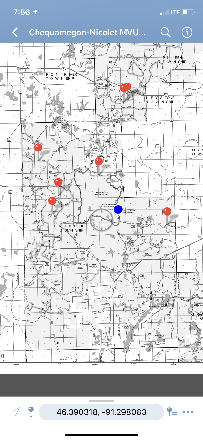
Recording my location....

Another beaver hotspot.....didn't stop this time.

The North Country Trail crosses through this area and I was crossing its road crossings more times than I could count.


Anyone that's followed my blog closely knows that I've a fondness for Horse Pasture Grade, first ridden on my first tour of Chad's Trans Wisconsin Adventure Trail.

Following Horse Pasture south, I wound my way to the north side of Pigeon Lake and this camp, another former CCC site. I parked outside the gate and walked the grounds which seemed not only closed, but almost abandoned. A quick search told me that the former Depression-era camp had been operated by the University of Wisconsin - River Falls as an environmental studies location but that expenses and declining interest in the courses led to the university system selling it back to the state of Wisconsin. On higher ground along the north side of the flooded Pigeon Lake my quick assessment didn't make the higher water the reason for non use and the pandemic's recent grip all things organized seemed too current for the condition of things on the grounds.
It is for sale.

One more ROAD CLOSED led me to believe that which I'd find at the barrier.


Even though it was actually too windy, I flew the drone anyway because I wanted a better look at the flooded lake. For a minute, I thought that I'd lost it since I had lost GPS signal for some reason and I have to guess that the reason was that my request for more altitude on the controller led to a couple of hundred feet rise in the heavy wind over a few seconds.
Just as we (no longer?!) do it on our rising water driveway, a marker was placed to gauge water level.

Back on County N, south side of the lake....the sign still there.

This wasn't rain....or dew but rather the road sweating. Freezing temperatures over the last couple of weeks had the ground very cold and the area's unseasonably warm weather left the paved roads wet....and slick. Someone we all know and love fell while street corner navigating in the urban Twin Cities the same day, his crash bars preventing something worse than his tremendously sore ribs.


Some of the property owners were able to lift their homes and cabins enough to save them, not everyone had that option. There were way too many buildings suffering damage. From what I read, "....no inlet or outlet, either springs or ground water....". I did see a report of an 18" rainfall but that couldn't have hurt anything.


Along Bayfield County N....


Another potential campsite exploration.....


You ain't nuthin' if you don't have or ride an off-road vehicle in the northland.

Less than a mile in from the western boundary of the National Forest, the squiggly line at my location marking this Buckskin Trail.

A stop for a snack at another North Country Trail trailhead, the water drop not for a Himalayan rider....


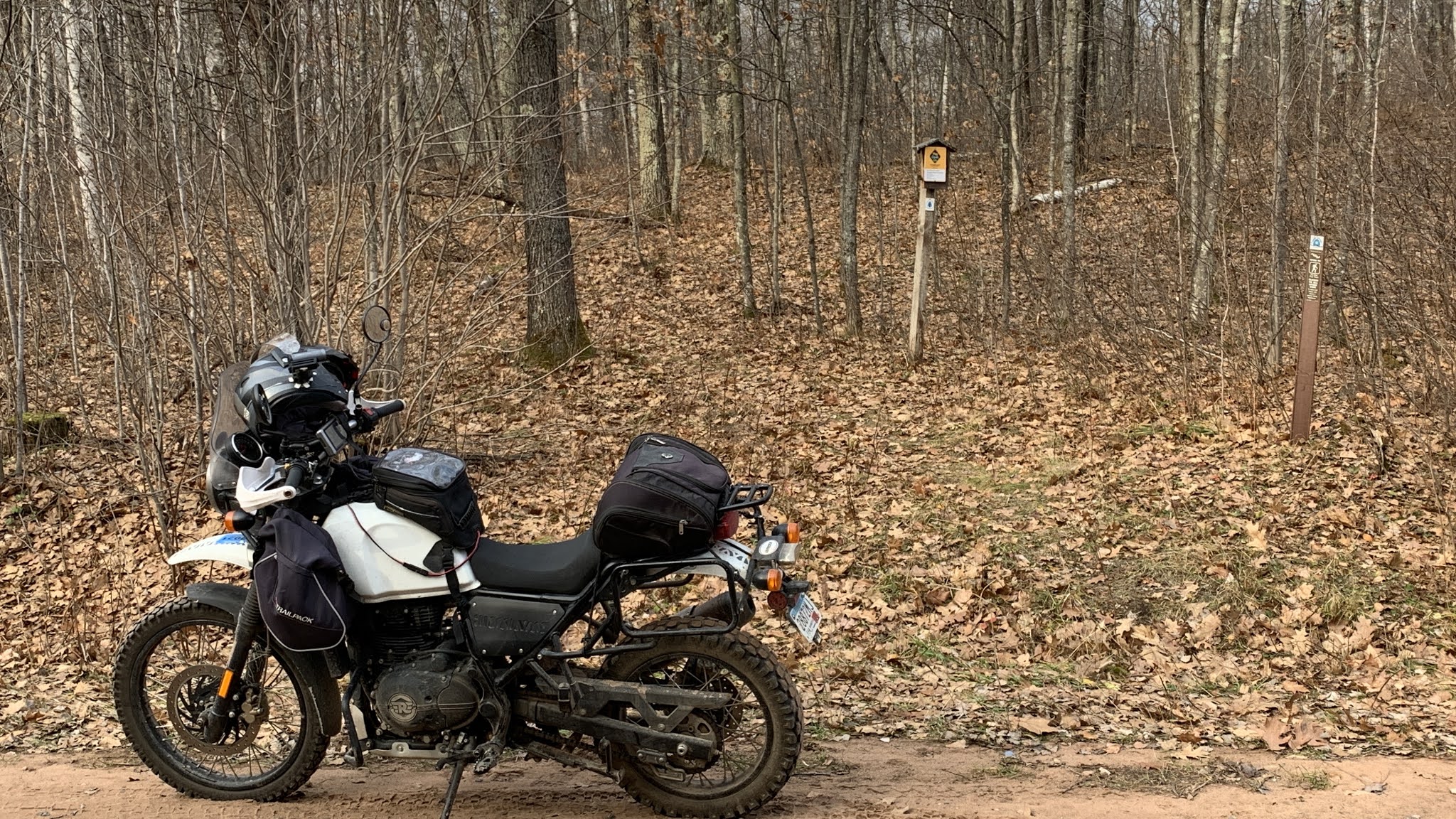
.....I had my own water AND trail mix.

Back to camp for a lunch....there was still ham and cheese and spicy mustard and green bean casserole minus the beans....there never had been any green beans.
I do believe it was even better than it had been the day before....Steve.

After lunch it was out and about.....


The sign advises, "Carry to Launch". Looks like swim to launch if you ask me.


Another secluded boat launch on another secluded lake.


You might just see a reddish maroon minivan camping at this Undisclosed Location next spring.

I needed...well...wanted some gasoline so I jumped on US 2 for a quick ride into Iron River. This is the same US 2 that on its eastern end visits St. Ignace, Michigan and on its western end drops down into downtown Everett, Washington. I had less than 8 miles to go.

'Know that site I mentioned above about visiting next spring?? Not if this Undisclosed Location spot is available instead.

Wanoka National Forest Campground, more evidence and there was a lot of it in camp of very large trees harvested, their stumps and trunks used as both furniture and utility devices around camp.


Not really much to say other than I was enjoying the heck out of these autumnal tracks.

Lots and I mean lots of PRIVATE property signs in what I'd understood was Federal property. I looked some of these plots up, curious about acreage owned.


Almost back to camp, I hadn't planned on a stop at the famous Delta Diner, a good thing too. As in times past, I seem to have a 50-50 shot at finding the place open, lucky that I don't make a lunch stop there the destination of every ride.
"Open again in January, Stay Safe!"

Another look at my campsite furniture....

Dinner time.....


Unbeknownst to me, I've got two copies of this MVUM map in Avenza and in all my jumping out of one map and climbing into others, I ended up waypointing points on both maps so I'll have to check both to find all of my Undisclosed Locations.
More campfire time, certainly an adequate amount of it, boredom not even the remotest possibility. Plans were being made for my last day or exploring.

The roads covered on Saturday...

A topographic look at them....

Finally another look at the weekend's travel.

Felt bad for the flooded folks..... nice drone footage.... and yeah got camping grub down to a fine art.
ReplyDeleteI first saw the flooding on County N, a section of it I don't think I've ever ridden. Noticed the built up road from a distance and then I saw why. Still hard to believe that a lake can misbehave like that.
DeleteThe cooking is fun when I can take a few more pieces of gear, I've been mixing more involved with simple and easy. Makes it more fun. Also, really enjoying my little 12V refrigerator but still learning how to balance power out and power in.
"Looks like swim to launch if you ask me." For some reason I found that very funny. :D
ReplyDeleteThank you, it was my first thought when I saw the sign and quickly deeper ramp.
DeleteNice ride report!
ReplyDeleteThanks Scott! I ran out of time but thought of you while I was working in Davenport. Looks like I'll be back there sooner than later, working around the I-80/61 intersection. I'll keep you posted.
DeleteLet me know when you get back down this way. We would love to see you.
DeleteWill do. I'm in SD the beginning of next week, will be 2nd week December at the earliest.
DeleteBTW Doug? Are you not on Facebook anymore?
ReplyDeleteI jumped off, never really got too involved so decided to cut that cord.
Delete