The Davis County Courthouse, built with "Second Empire Architecture, red brick covered with sandstone veneer." What I do understand is that it's a very stately building in a beautiful town square. I sat on a shady bench late yesterday afternoon and enjoyed the breezes.
Waited until this morning for better light to take the photo.

Almost across the street is one of the Iowa Welcome Stations, this one in an original house purchased from Sears Roebuck & Co. After walking over, I had a grand time visiting with the two friendly and knowledgeable women inside. For $1800 1915 dollars you could have this house delivered on a rail car to Iowa. For another $36, the matching outhouse would be included in your package.
Note the horse and buggy to the left. Between yesterday and today I met or passed probably a dozen horse drawn rigs, some on roads that were quite busy. There were more women/girl pilots than males.

Even though a fork of the Historic Hills Byway goes right through Bloomfield, I wanted to start at one of the forks' beginnings so I rode west and north to Moravia. It was already getting warm and sticky, so my gas stop was a quick one for a bottle of water and a fill-up.

I experienced these large water towers a few years ago when I rode the Helix down to Arkansas. Seeing these large vessels out in the middle of nowhere (high places) was something new to me. In rural MN and WI seeing a tower on the horizon means that you're coming upon a town. That is not the case in southern Iowa and northern Missouri.

While confirming my ride plans last evening and looking over the maps I made a sudden discovery and that is that water flows downhill. Earlier posts have verified that the Mississippi River to the north (where I live) is flooding so naturally all of that high water is moving south along the eastern side of Iowa. The floods I'd seen around Marshalltown on Saturday and the areas I rode through on Sunday around Ottumwa are Iowa rivers and those rivers in general terms flow to the southeast to meet the Mississippi, both drainage systems impacting the other where they converge.
The discovery last night was that rather than being past and avoiding more floods, I would instead be heading right into the heart of the beast. All sorts of online searches were done; Iowa DOT, road closure notices, news reports, etc. Anything I found was either very general or from last week.....BEfore the weekend heavy rains. I didn't want to change my plans but decided that I needed to be familiar enough with where some of the larger highways (higher bridges and approaches) might be so that reasonable Plan B's and C's could be utilized or at least prepared for.
My first real stop today was in Keosauqua which is in Van Buren County. I became interested in visiting Van Buren County a few years ago when I learned that there isn't a traffic stop light in the entire county, something I found difficult to imagine, even in mostly rural Iowa. Today I rode through the county and never had to stop for a red light. I stopped in the Keosauqua City Park to cool off and watch the fast moving, silty Des Moines River tumble by. The Des Moines originates up in Minnesota and is Iowa's largest river, flowing from NW to SE across most of the state.
A big old cottonwood (almost 4' in diameter) river-side, the stately old Manning Hotel with outstanding river views from the old balconies.


I mostly succeeded in showing the zillions of tufts of cotton blowing from the old tree.

From Keosauqua it was on to Historic Bentonsport, further down river on the Des Moines and another stop for shade...after walking out onto the old historic bridge.

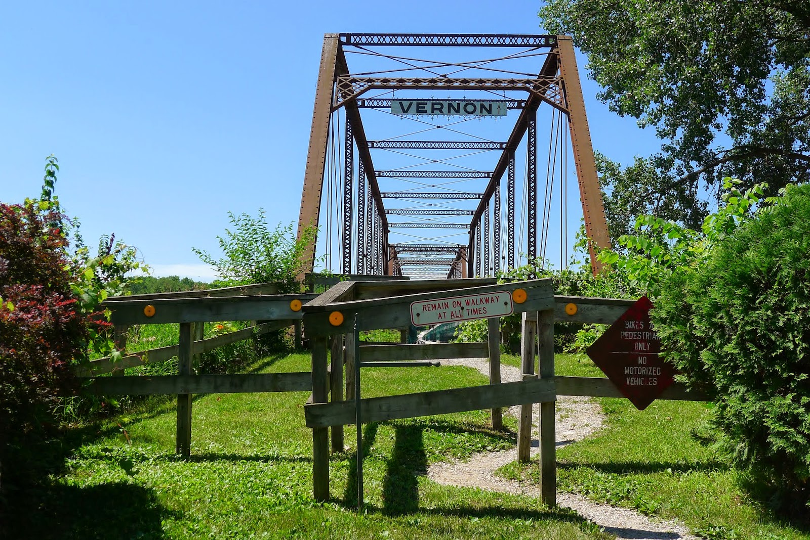
A restoration project was carried out, the center walkway across the bridge reinforced and safe. The structure on both sides of the center is not quite in as good of shape.


Looking upriver....

Back from whence (don't ever remember using that one before ;) I'd come.

Adjacent gift and sweet shop, part of the row of historic structures beyond ......

I stopped again in Bonaparte to snack on some chips and more water. Shade was abundant on the city park bench and I think I dozed, at least a half an hour disappeared. Just east of town on Iowa #2, Iowa #81 goes south.
I took it.......and then turned around and headed back into Iowa and on to Ft. Morgan on the overflowing Mississippi.

I wanted to check out the local Mississippi River flooding so headed down to Montrose to see first hand what was happening. Hwy #61 is closed into Missouri at or near Keokuk which is really where I wanted to go. Keokuk is right down in the corner of the state, in a portion of the state that dips down into the corner of adjacent Missouri.
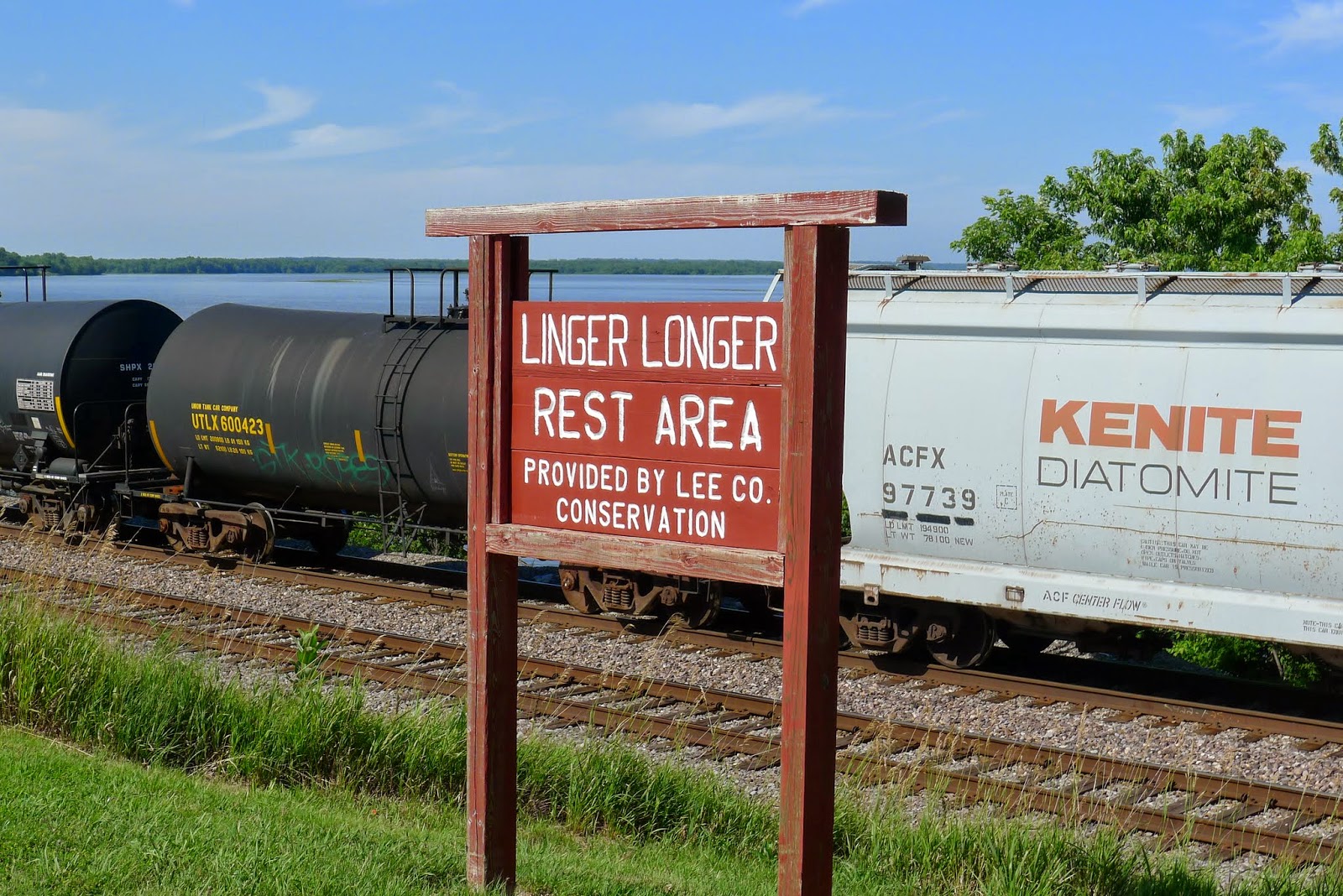
Just north of Montrose, I saw this little wayside next to the river; this a typical scene along the river. Highway next to railroad tracks next to river.
The Pioneer Trail refers to the trek west that the Mormons made after leaving Nauvoo, Illinois which is directly across the river from here. They had built a huge settlement there, hoping to stay but were persecuted to the point that they decided to leave everything that they had built and head west, finally settling in Salt Lake City.
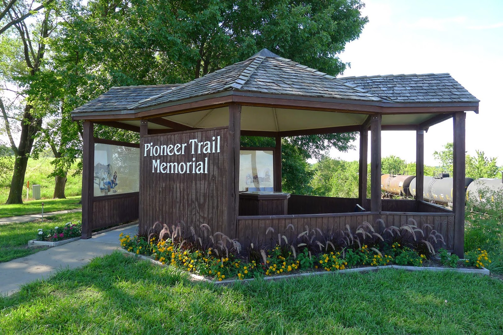
Looking across the river into Illinois to Nauvoo, the early settlement of the Mormons, the large temple easily rising above its surroundings. This was all the zoom my camera lens has, the temple 2 miles across the wide river.


The last day and a half I've been riding along the Mormon Trail, the route the Followers used across southern Iowa on their way to Utah.

Diary entries from the 1880's with comments about leaving all they'd built behind and forging west with hardships felt and expected.

I tried taking the river road from Montrose south to Keokuk but didn't get very far at all so I turned around and headed into the older part of downtown Fort Madison. The reconstructed Fort Madison, currently in a great deal more water than it had been originally.


One of the things I had planned on seeing in Fort Madison was the Sheaffer Pen Museum but the hours of operation are so restrictive that I didn't make it today and just couldn't bring myself to hurry through the day to make it on time. I did walk around downtown later on and take a photo of the location however.

The look behind buildings in a typical old River Town.

Some urban renewal, a very upscale hotel and eatery in the same block.

It sounds like we'll have storms overnight, I still haven't had to cope with any rain. I plan to do another Byway tomorrow as I work my way north and it would be great if I can follow my GPS Route without too many detours. I'll do my best to visit a museum and get there during Open hours.
Some beautiful scenery for sure. Such blue sky. I am glad it rained at night and not during your ride.
ReplyDeleteI really like the old courthouse. Judging by the police car out front it looks like they might still use it as one.
I turned on the news last night. No news of storms or flooding, just shootings in Chicago and the fighting in the Middle East. Sigh.
There are trees in central Iowa, just not so many, there places taken by crops. Like you, I was looking for more flood news last night and mostly heard about 'other'.
DeleteYes, the courthouse is very much in use. Had it not been a Sunday afternoon, I'd have taken a look inside.
Lots of scenery but where are the people?
ReplyDeleteThe bridge over the muddy waters is something I would have explored as well, even with the warning signs posted...
A summer Monday only a week after the July 4th holiday most likely has everyone back at work. These last years I've not seen tourism as I did only a few years ago. Everywhere I go the feeling is that folks are staying closer to home and seems fairly universal.
DeleteCoop it looks like a beautiful spot ... where is the flooding?
ReplyDeleteKaren, the eastern edge of Iowa IS the Mississippi and we (upriver Minnesota) have been sending high water down river for what must now be many weeks. That's been our heavy rainfall. Over the last week, central Iowa has seen much rain and now the flooding is in the SE quadrant, rushing towards the Mississippi. Much of the high water has already subsided.
DeleteDoug, well what do you know!
ReplyDeleteThere is barely a day that has past since college, that hasn't seen my fingers wielding a Sheaffer pen.
My go to Sheaffer for the past thirty odd years is a Targa model from the mid '70s with a rare italic nib. Makes for a wonderful signing pen. That's something I've done daily for most of my career.
It's nice to know I own two items that have museums.
David, I knew nothing other than recognizing the company name. I DO know that good pens meant something to family members a generation ahead of me. BIC's were what I grew up with.
DeleteI was really hoping to visit the museum to learn something new. Now what I know is that I need to come back down.